Getting to the heart of what matters in the Sawtooth National Recreation Area
Planning Ahead After Fires on the Sawtooth National Recreation Area
Looking forward to the summer? Did you hear about the wildfires that burned in the area in 2024? Here are some resources to help you plan your trip to the Sawtooth National Recreation Area this year. Make sure to also check camping and Wilderness rules.
What Burned?
Numerous fires recently burned on the Sawtooth National Recreation Area and beyond. The fires listed below are the larger fires and/or fires that burned near campgrounds, dispersed camping areas, designated trails, and roads.
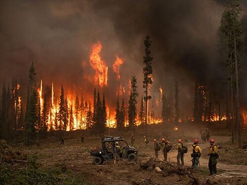
Night operations on the Wapiti Fire 9.8.24. Photo: inciweb
Started: July 24, 2024
Cause: Lightning
Size: 129,063 acres
Location: 2 miles southwest of Grandjean, Idaho on the Boise NF, pushed the fire onto the Sawtooth National Recreation Area and into the Sawtooth Wilderness the week of Aug. 19, 2024.
Grandjean Campground – Surrounding area burned, a few trees in the campground burned but there is still plenty of shade. A few picnic tables were impacted and will be replaced by the beginning of the summer season.
Sheep Trail – Lost trees during the Wapiti Fire, there are still green trees and there will be some shade. No infrastructure was lost.
The following campgrounds were unaffected by wildfires. However, the areas surrounding them were impacted by fire to varying degrees.
Iron Creek Campground
Stanley Lake Campground
Elk Creek Group Campground
Trap Creek Group Campground
Dispersed Camping
Some dispersed camping areas were affected by recent wildfires. Refer to fire perimeter maps to determine if dispersed camping areas were affected. Dispersed camping is allowed where designated on motor vehicle use maps.
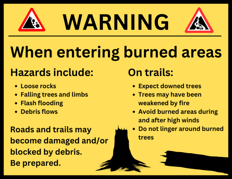
Hiking Trails
Refer to fire perimeter maps to determine if your route may have been affected by a fire. Expect downed trees across the trail and be aware of hazards including falling or weakened trees and limbs, loose rocks, flash flooding and debris flows. Avoided burned areas during high winds and camping under burned trees. Check the Sawtooth National Recreation Area trail report for more specific information.
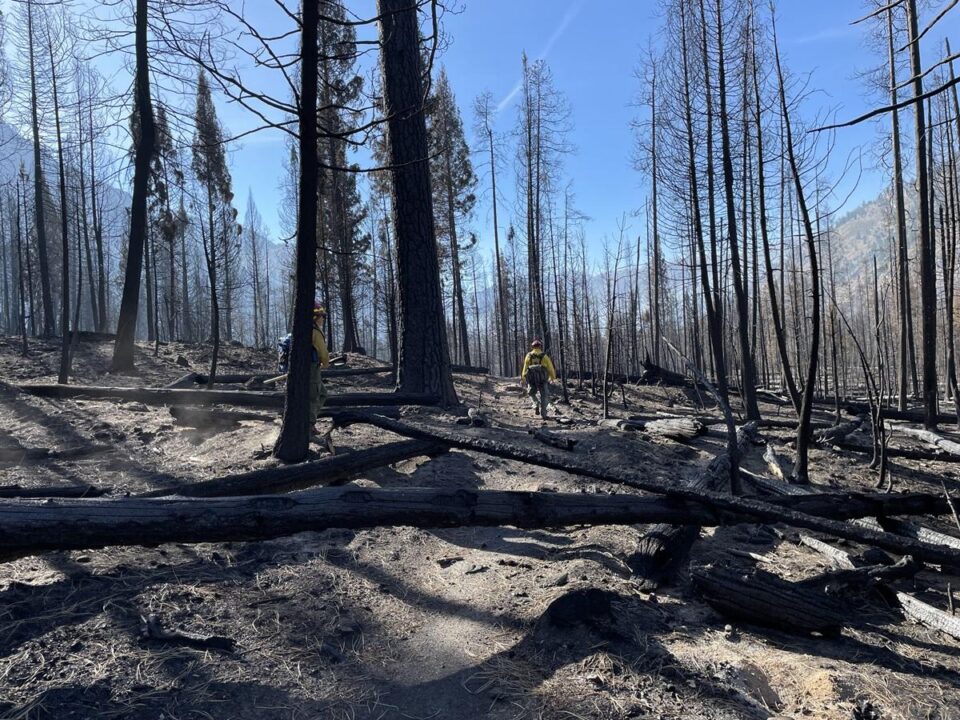
Trees down across the trail in the Wapiti Burn. Photo: Inciweb
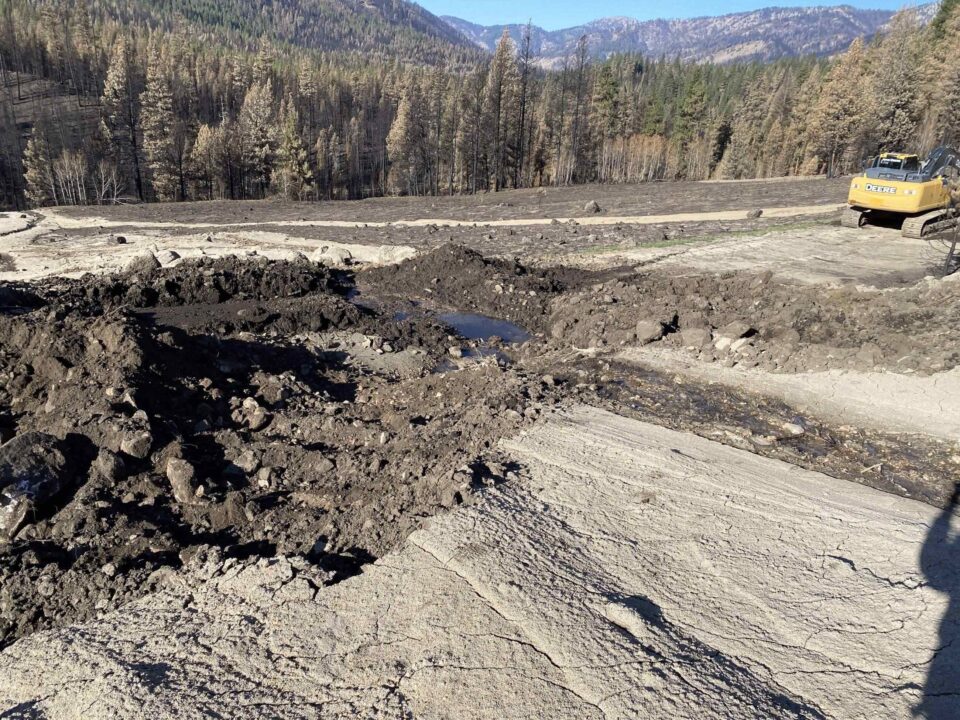
Debris flow across the Grandjean Road after the Wapiti Fire. Photo: Inciweb
What does this mean for my trip?
The Sawtooth National Recreation Area has no predicted closures due to 2024 wildfires at this time. The impacts of these wildfires are hard to miss and can feel heartbreaking, however, they are an important part of our lodgepole ecosystem. In the coming years we will be able to watch changes as plants and animals return to the area. Even the first summer after a fire you may be surprised to see how many plants have already started to regrow.
Here are some things to consider as you plan your trip.
Identify your goals for visiting.
Do you want to see the changes?
Do you want to avoid all burned areas?
Be prepared for things to look different! Change is natural.
Pay attention to potential hazards that never used to be in the area.
Be ready for more people in locations not affected by wildfire, and fewer in areas affect by fires.
Have flexibility in your plans. Check out the provided maps to see areas that were not impacted by recent fires.
New growth in the Wapiti burn scar 11.12.24. Photo: Wapiti Fire Information 2024 Facebook
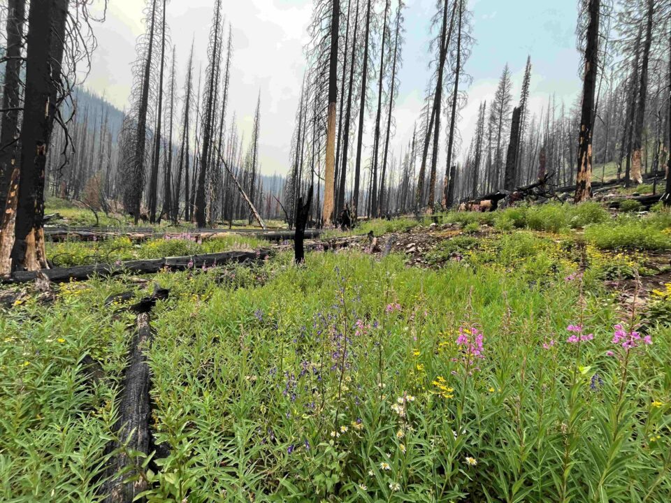
Abundant wildflowers growing in the Ross Fork burn scar 2 years after fire. Photo: SIHA
Meadow grasses sprouting after the Wapiti Fire 11.20.24. Photo: Inciweb, Monica Morrison
Pronghorn in the burned area of the Wapiti Fire 10.5.24. Photo: Wapiti Fire Information 2024 Facebook
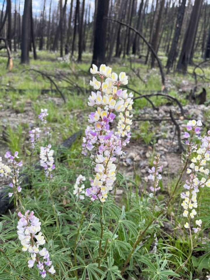
Lupine growing in Ross Fork burn scar 2 years after fire. Photo: SIHA
Mosaic Burns
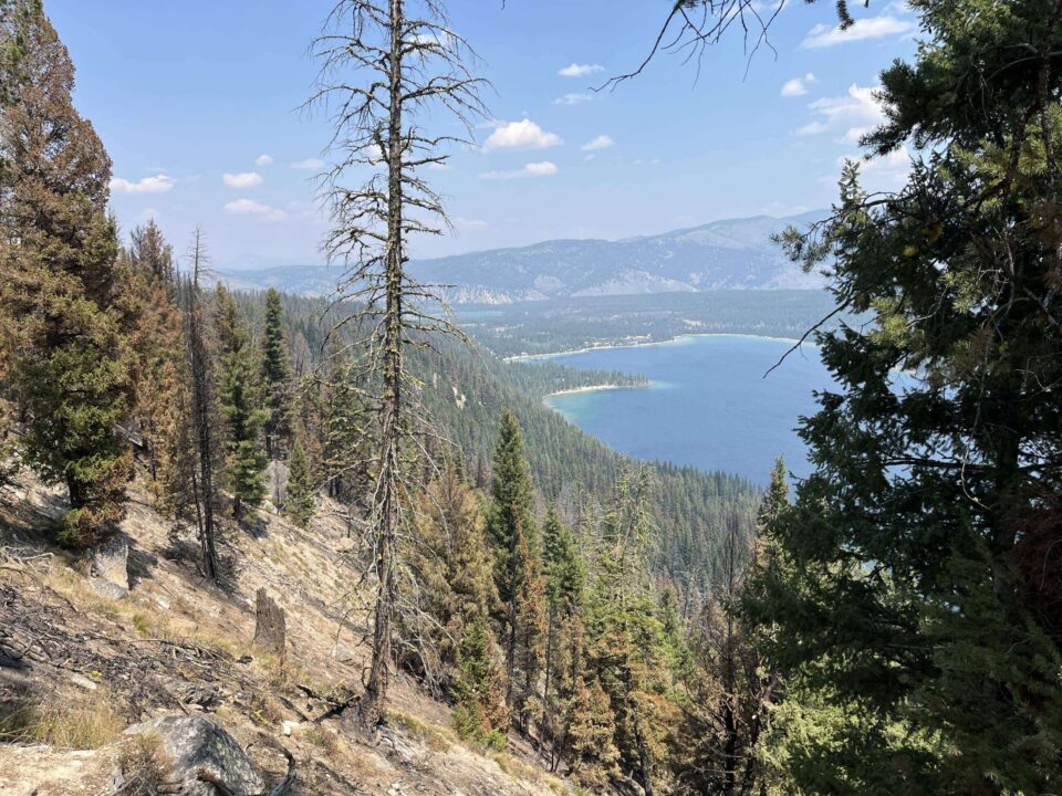
Wildfires on the Sawtooth National Forest generally burn in what is called a “mosaic pattern”. This means some areas burned very hot while other areas were skipped or had a low-intensity underburn with no trees killed.
Graphic: USFS
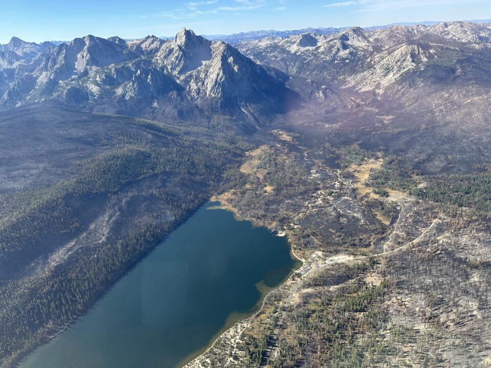
Aerial view of Stanley Lake area with a mosaic burn. Photo: Inciweb
Bench Lake fire mosaic burn above Redfish Lake. Photo: Inciweb
Aerial view of Grandjean area with a mosaic burn. Photo: Inciweb, Monica Morrison
Other Changes You May See
On your visit to the Sawtooths you will likely see ash and charred trees from wildfires. However, you may notice other changes to the area as well. New burn piles, cut down trees, widened trail or road corridors may also be the result of efforts to put out wildfires.
During a wildfire, fire breaks may be cleared and natural or existing breaks may be widened like trail or road corridors. Fuels reduction, cutting small trees or brush, also helps prevent the spread and intensity of a fire by reducing available fuels. These are all important tools firefighters use to attempt to contain and extinguish wildfires. After a fire has burned, suppression repair takes place. This repair helps mitigate erosion, reduce visual impact, restore natural vegetation, and prevent unauthorized roads or trails being established on the fireline. Despite crews best efforts it may take several years for some areas to look more natural.
Utah Engine 411 completing fuels reduction and repair. Photo: Inciweb
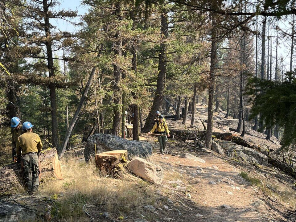
Crew repairing fireline along a trail. Photo: Inciweb
Dozer creating fuel break on Decker Flats Road. Photo: Inciweb
Burn piles from fireline construction. Photo: Inciweb