Getting to the heart of what matters in the Sawtooth National Recreation Area
Excavated by Ice
Did you know that ice can flow across land? When enough ice and snow accumulate in one area, it can begin to move under its own weight. At this point, it’s referred to as a glacier. I’ve always been fascinated by how the Sawtooths were formed, how they got such rough peaks, and by the role glaciers played in their development.
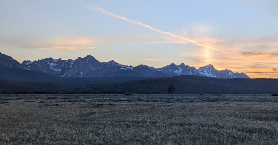
Sawtooths from highway 75. Photo credit: SIHA Staff
The Sawtooths are known for their distinct, jagged peaks rising up above the surrounding area. But how did those peaks and mountain ridges get their shape? The Sawtooth batholith is around 50 million years old, so the mountains have been through a lot in their time to influence how we see them today. One of the events that had the largest impact on the mountain ranges in the area was glaciation. The Sawtooth range was one of the only areas in central Idaho to experience glaciers, and they drastically changed the landscape.
The last time we had glaciers in the Sawtooths was between 25,000 and 7,000 years ago. During these glacial times, you would have found the Sawtooths enveloped by sheets of ice and snow miles wide. But these ice sheets weren’t just sitting on top of the landscape. One of the key characteristics of a glacier is that they move under its own weight. How does this happen? Gravity. Glaciers are so large that gravity pulls them downhill. As this happens, the ice on the front and bottom of a glacier scrapes against the ground, pushing massive amounts of soil and rock forward. This scraping caused the ice to melt and flow in front of and under the glacier, causing it to move faster. This glacial movement carves valleys and erodes mountainsides to give us a landscape that we can still see today.
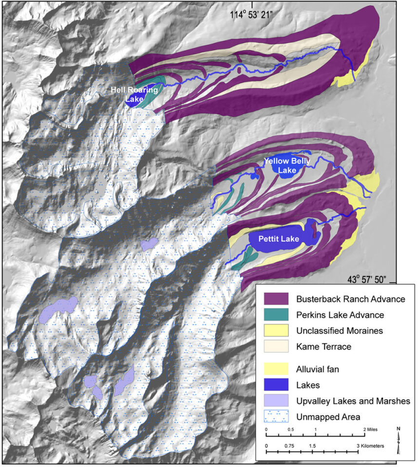
However, glaciers don’t just move forward. As it gets warmer and there’s less snowfall, glaciers start to shrink. The parts of the glacier that shrink fastest are the parts at lower elevations; this causes the glacier to retreat up the valleys it carved to higher elevations. As this happens, the sediment and rocks that have been pushed forward are left behind as deposits and hills that we call moraines. These can also be very big changes in the landscape. In the areas around Stanley, such as Pettit and Alturas Lake, we can see evidence of several different moraine deposits. This tells us that glaciers in the area retreated and advanced several times while they were here, carving and rearranging the landscape differently each time.
Map of glacial moraines near Pettit Lake, Yellow Belly Lake, Hell Roaring Lake. Photo Credit: Lundeen, 2001
Once the glaciers in the area melted and receded, the mountain range was forever changed. Massive U-shaped valleys were carved that we can still see here at Redfish Lake. Many of the alpine lakes were later formed in glacial valleys. The glaciers melting also had a massive impact; so much water was released along with saturated frozen soil, causing solifluction, where the top layer of soil mixes with water and flows downhill. This left the mountain peaks and crests extremely barren and rocky compared to the surrounding area.
So, next time you’re looking at the jagged peaks of the Sawtooth mountains, remember that many of the key features you see were the result of glaciers in one way or another.