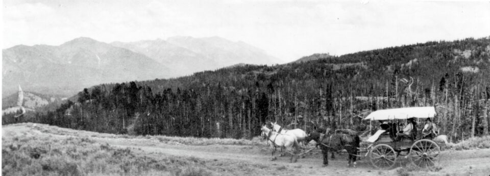
A carriage descending Galena Hill to Ketchum (Shaw Collection – Stanley Museum)
People visit the Sawtooths for endless reasons. Maybe it’s a family tradition, the allure of the wild, or a quest to recreate an Instagram photo. Regardless of what brought you here, how you got to the Sawtooths is the same for everyone…you drove on a road. While the adventures here are what make trips memorable, there would be no trip without the roads. There are two roads into the Sawtooths – state Highway 75 and 21. This is the history of these roads, the paths that preceded them, and the extensive work it took to pave the paths we all use to get to the untrammeled wilderness of the Sawtooth National Recreation Area.
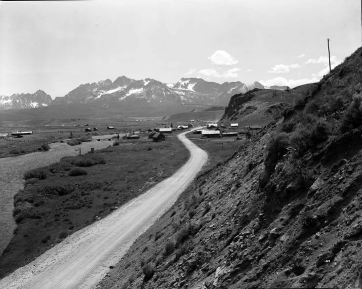
Lower Stanley and the Sawtooth Range (Photo from ITD Public Archives)
The first people to live in Sawtooth and Salmon River Country were the native tribes whose homelands encompass South and Central Idaho. This included the Shoshone-Bannock Dukudika (Sheep Eaters) and Agaidika (Salmon Eaters) tribes, the Nez Perce, and other indigenous groups. Native tribes travelled in and out of the Sawtooths to hunt and gather. Evidence supports native peoples in the valley up to eleven thousand years ago. But indigenous peoples had a presence across all surrounding ranges.
“One Indian trail used in these wanderings cross the Sawtooth Range was by way of the present Smiley Creek. And certainly, there were other frequently used routes over the mountains, to the Wood River drainage, to the South and Middle Forks of the Boise, and to the South Fork of the Payette.” – Goodwin and Hussey, ‘Sawtooth Mountain Area Study Idaho: History (U.S.F.S., 1965)’
These well-traveled trails would be the routes trappers and miners used to enter the area during early westward exploration.
In the early 19th century, British and American fur trappers were fighting for more territory deep in the Rockies. This quest drove explorers into present-day Idaho. The first documented Euro-American to see the Sawtooth Valley was Alexander Ross, in September 1824. Ross’s British-sponsored trapping brigade followed the Big Wood River to the watershed boundary, arriving at Galena Summit. Upon reaching the summit, Ross noted, “No elevated height in this country can present a more interesting prospect than that viewed from the top of Mount Simpson [Galena Summit], the west in particular.”
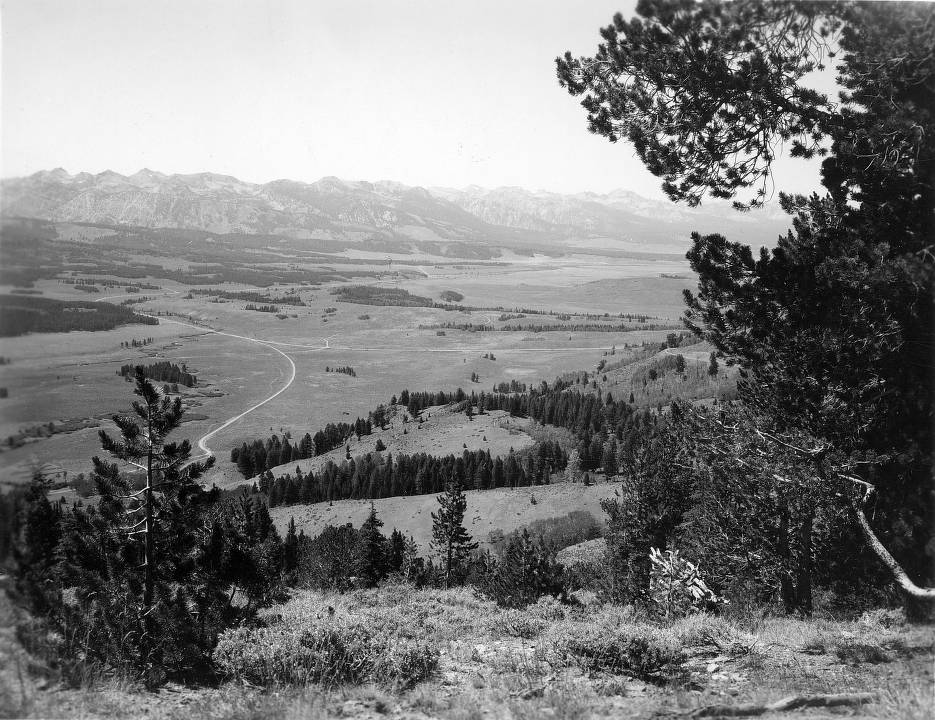
Galena Summit looking West at the Sawtooths, 1969 (Photo from ITD Public Archives)
After hunting and trapping, the party left the valley mid-October, descending the Salmon River. Where they entered and exited would be the future path of Highway 75. The British policy at the time was to eradicate all beavers in the area to discourage American trappers from heading Northwest. By the fall of 1830, the regional beaver population had been wiped out. Without the promise of pelts, there was no reason to venture into the rugged mountains. The Sawtooths’ destiny wouldn’t manifest again for another 30-plus years until the discovery of gold.
In July of 1863, coming east from Idaho City, a 23-man crew entered the Sawtooth Valley in search of gold. Panning in the Stanley Basin, named after John Stanley, the oldest member of the expedition party, they were struck by the area’s beauty. Despite finding some gold, being too far from reliable supplies to establish a permanent operation, the party returned towards the Boise area. The Sawtooth Valley was again left alone for nearly two decades.
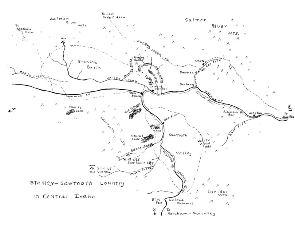
Hand drawn area map depicting historic routes and mines (from Stanley-Sawtooth Country by Esther Yarber & Edna McGown)
In 1878, three mining operations were established in the area. These mines were the Land of the Yankee Fork, two mining towns near the Salmon River headwaters, and claims in the Stanley Basin. These operations established the first consistently maintained roads into the area. The town of Stanley sprang up as a rest stop at the crossroads between these mines.
In 1879, a toll road was built to move supplies from Challis into the Yankee Fork area. From this road, a crude horse path connected to Stanley upriver. This road was superseded in 1890 when a free road was constructed along the Salmon from Challis to Stanley. Near the Salmon headwaters, a rough wagon road over Galena Summit had existed for years. But in 1880, the road was improved by the Columbia and Beaver Mining Company for $10,000, and the Galena Toll Road was established. This road was primarily built to connect the mining towns of Sawtooth City and Vienna with the smelter in Ketchum, but the road continued north toward Stanley.
Leading out of Stanley, Nip ‘n Tuck Road traveled into the Stanley Basin and beyond to Cape Horn, where it split north towards Seafoam Mine and southwest, following present-day Highway 21, to Idaho City. However, mining was a boom-and-bust operation, and by the late 1880’s the area grew quiet again. While mining activity flared up occasionally, the number of people in the valley stayed low for years, until the dawn of a new age: The age of automobiles.
(The story continues with next week’s blog ‘The Roads to the Sawtooths: The Age of Automobiles”)
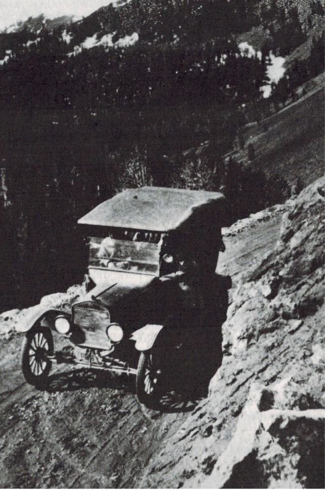
Model T Ford Going over Galena (from Stanley-Sawtooth Country by Esther Yarber & Edna McGown)
Cush is a third-year naturalist with SIHA. He enjoys backpacking, birding, and watching the sunset behind the Sawtooths from his big front lawn.